Answers, not angles
Sun position is only useful after it answers a lived question. I kept the solar model underneath and made morning light, afternoon light, plants, and winter the primary outputs.
Sunlit · Product case study
3 minute read · 2026
I designed and built a browser-based tool that turns an address, window direction, and a few physical constraints into plain-language answers—before someone signs a lease.

“Will the room feel bright at breakfast?” is not the same question as “What is the solar azimuth at 9 AM?”
Light can change whether an apartment feels calm, supports plants, or needs lamps all day. But renters usually have to infer that from a compass app, a map, and a short viewing.
Existing tools often stop at simulation. The opportunity was to build a decision tool: keep the calculation rigorous, then translate it into the questions people already use.
If the setup feels like describing an apartment—not operating a solar model—people can reach a useful light portrait in a few minutes.
Locate the apartment and confirm the right result.
Orient the window with a direction or a wall on the map.
Read when direct light arrives and what it means in daily life.
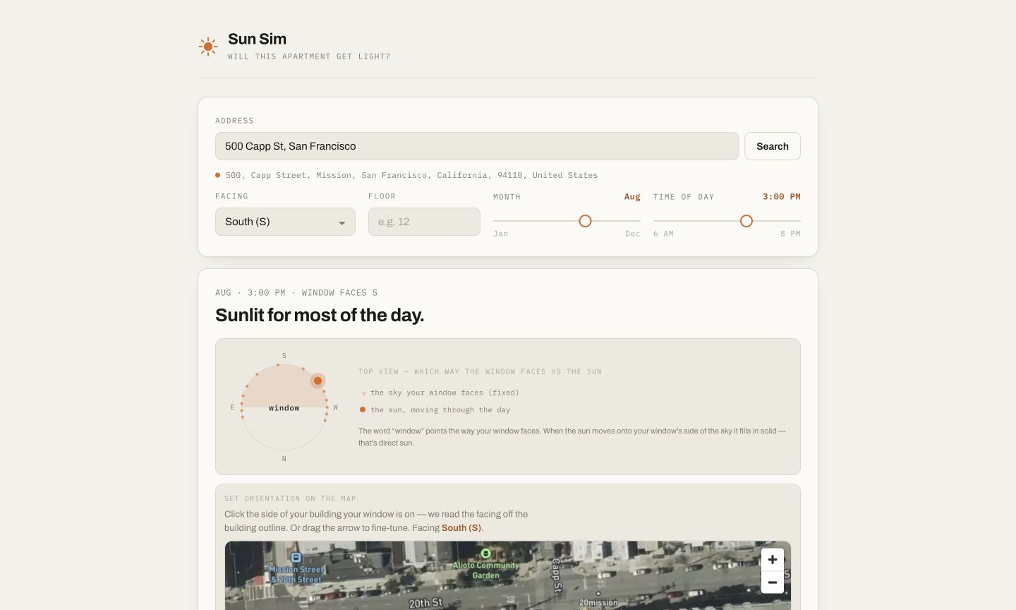
Sun position is only useful after it answers a lived question. I kept the solar model underneath and made morning light, afternoon light, plants, and winter the primary outputs.
An address can resolve to the wrong building and a compass label can feel abstract. The flow keeps candidate selection visible, then lets people click a wall on the map; the map, compass, and direction field stay in sync.
The first useful version needed only location, facing direction, and solar geometry. Floor height and the building across came later, without turning the core experience into a technical setup form.
Address · facing · floor · month · time
OpenStreetMap geocoding · SunCalc solar position
Mapbox orientation · optional building obstruction
Timeline + room depth + four lived-light summaries
The app runs entirely client-side, with no backend. An address is geocoded through OpenStreetMap; the satellite map and building outlines come from Mapbox. When the address is in New York City, it pulls NYC Open Data building footprints and roof heights to estimate the building across automatically; everywhere else, you enter that obstruction by hand.
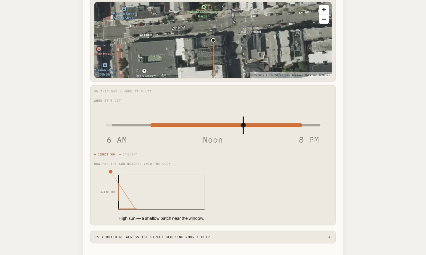
A public, working web product that accepts real addresses and produces a decision-oriented light portrait, with optional context for floor height and the building across.
Test the language and setup with apartment hunters, then learn whether a side-by-side Compare apartments flow changes an actual shortlist. That feature is intentionally not claimed as shipped.
What I learnedAccuracy is necessary, but it is not the product. The product is the moment technical evidence becomes a decision someone can trust.
See the decision tool in context.